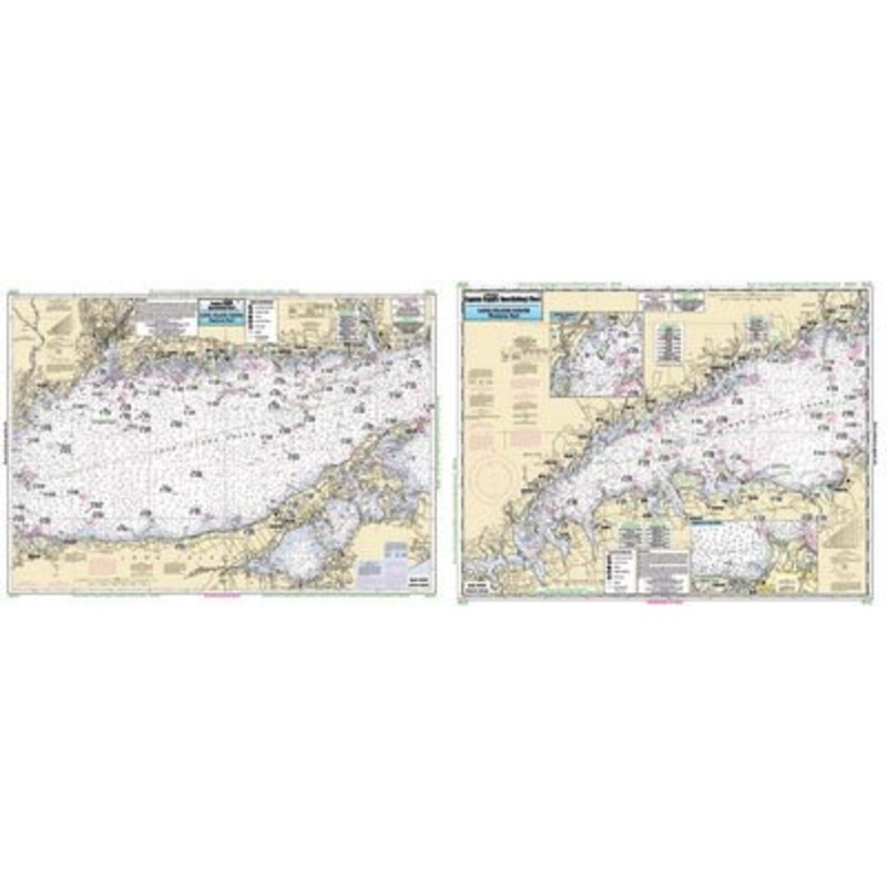
Captain Seagull's Long Island Sound NYNearshore Nautical Chart is a Neashore chart showing 10 to 20 miles off. Chart is 19 x 26 inches, double sided, and laminated. Long Island Sound, NY. A fishing chart of the entire Long Island Sound. Side A: from Whites
Captain Seagull’s Long Island Sound NYNearshore Nautical Chart is a Neashore chart showing 10 to 20 miles off. Chart is 19 x 26 inches, double sided, and laminated. Long Island Sound, NY.
A fishing chart of the entire Long Island Sound. Side A: from Whitestone, NY east to the Housatonic River or Stony Brook, NY. Has a detail of Captain Harbor, Norwalk Harbor and Smithtown Bay. Side B: from the Housatonic River east to Orient Point, NY or South Lyme, CT. All charts include GPS coordinates, wrecks, reefs, shoals, fishing areas, amenities and restrictions.
Captain Seagull’sLong Island Sound NYInshore Nautical Chart – Model # LI15


Copyright © 2025 .All Rights Reserved.Powered by www.terminaltacklew.com
Reviews
There are no reviews yet.