This is our last remaining inventory of maps. Atlantic Mapping is out of business, but we have a few left. Atlantic Mapping offers hardcopy charts that are a synthetic waterproof material folded and in a zip lock bag. They specialize in underwater informat
This is our last remaining inventory of maps. Atlantic Mapping is out of business, but we have a few left.
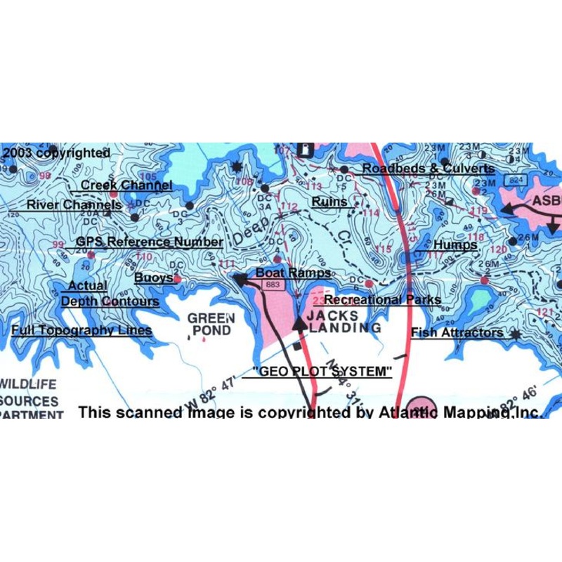
Atlantic Mapping offers hardcopy charts that are a synthetic waterproof material folded and in a zip lock bag. They specialize in underwater information from topography to submerged structures. They also provide road networks around the lake so as to help you find your way. Then not to be forgotten is the “GEO Plot System” which has been incorporated onto many of their lake charts. The “GEO Plot System” allows plotting of personal coordinates without a PC. Marina’s, bait shops, convenient stores and other locations are often updated to maintain accuracy. Whether your pleasure boating, camping, or fishing; you won’t find a better quality lake chart anywhere.
Copyright © 2025 .All Rights Reserved.Powered by www.terminaltacklew.com
Reviews
There are no reviews yet.