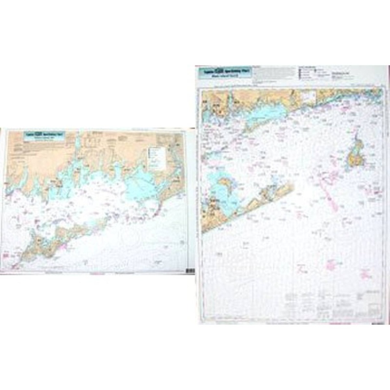
Captain Seagull's Block Island Sound/Fisher's Island NY Nearshore and Inshore Nautical Chartdetails the bays and Islands. Chart is 19 x 26 inches, double sided, and laminated. Rhode Island, Connecticut & New York. Side A: Inshore chart of Fisher's Island S
Captain Seagull’s Block Island Sound/Fisher’s Island NY Nearshore and Inshore Nautical Chartdetails the bays and Islands. Chart is 19 x 26 inches, double sided, and laminated. Rhode Island, Connecticut & New York.
Side A: Inshore chart of Fisher’s Island Sound from Westerly, RI west to Groton- New London Airport, includes Little Narragansett Bay. Side B: Nearshore chart from Niantic Cove, CT and Gardiners Bay, NY to east to Pt. Judith, RI and south to Jennie’s Horn fishing spot. All charts include GPS coordinates, wrecks, reefs, shoals, fishing areas, amenities and restrictions.
Captain Seagull’s Block Island Sound/Fisher’s Island NY Nearshore and Inshore Nautical Chart – Model # FIO10

Copyright © 2025 .All Rights Reserved.Powered by www.terminaltacklew.com
Reviews
There are no reviews yet.