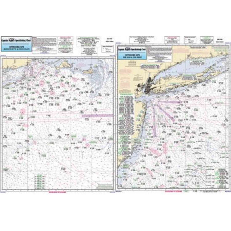
Captain Seagull's Canyon Chart MA, RI, CT, NY, NJ Offshore Nautical Chartis an offshore chart off MA, RI, CT, NY, & NJ, 90 to 100 miles off coast, Double sided, laminated, 19 x 26 inches. Side A: Nantucket Shoals to tip of Montauk, NY, south to cover all c
Captain Seagull’s Canyon Chart MA, RI, CT, NY, NJ Offshore Nautical Chartis an offshore chart off MA, RI, CT, NY, & NJ, 90 to 100 miles off coast, Double sided, laminated, 19 x 26 inches.
Side A: Nantucket Shoals to tip of Montauk, NY, south to cover all canyons beginning with the Veatch Canyon. Side B: extends from Montauk to Five Fathom Bank off Cape May, NJ. This chart has sister charts the ONJ19 and ONY59. All charts include GPS coordinates, wrecks, reefs, shoals, fishing areas, amenities and restrictions. Also refert to AT206, BKL207, CRM208, MVN116, SCC103, BB14, PJ13, FIO10, FI105, LI15, SLI107, MP108, & NB104, JH113, NYH114, NNJ109, & SNJ110
Captain Seagull’sCanyon Chart MA, RI, CT, NY, NJ Offshore Nautical Chart– Model # OFGPS18

Copyright © 2025 .All Rights Reserved.Powered by www.terminaltacklew.com
Reviews
There are no reviews yet.