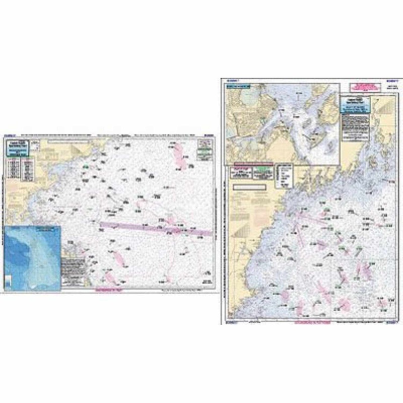
Captain Seagull's Gulf of Maine, Massachusetts Bay Nautical Chart is a anOffshore chart off 90 to 100 miles off coast, double sided, laminated, 19 x 26 inches, Maine, New Hampshire, and Massachusetts. Offshore chart, Side A, the Gulf of Maine from Penobsco
Captain Seagull’s Gulf of Maine, Massachusetts Bay Nautical Chart is a anOffshore chart off 90 to 100 miles off coast, double sided, laminated, 19 x 26 inches, Maine, New Hampshire, and Massachusetts.
Offshore chart, Side A, the Gulf of Maine from Penobscot Bay to Boston, Massachusetts Bay, includes an inset of Portland Harbor, ME. Side B, Massachusetts Bay, Boston south to Provincetown and Duxbury, MA includes a bathymetric inset of Stellwagen Bank. Use Bathymetric charts in conjunction with this chart, Jeffrey’s Ledge area is CA201, or Cashes Ledge & Stellwagen Bank, IC209. Inshore charts in this area are NS101, BH102, DS112, WB111.
Captain Seagull’sGulf of Maine, Massachusetts Bay Nautical Chart– Model # GMM17
Copyright © 2025 .All Rights Reserved.Powered by www.terminaltacklew.com


Reviews
There are no reviews yet.